

Drone Construction Services
Track and Showcase your Progress and Milestones.
Monitor progress.
Identify issues early.
Keep stakeholders engaged.
With a wide variety of stunning visuals.
Timelapse Video
Our drone-captured time-lapse videos offer a dynamic and compelling way to showcase the evolution of your construction project. By compiling high-resolution aerial footage taken at regular intervals, we create seamless videos that highlight progress from groundbreaking to completion. These visually stunning time-lapses engage stakeholders, support marketing efforts, and provide a clear record of project milestones, helping you communicate your vision with impact.
Continuous Progress Tracking: Regular drone flights capture every phase, creating a fluid narrative of your project’s development.
High-Resolution Clarity: 4K footage ensures crisp, detailed visuals, perfect for large displays or online platforms.
Customizable Timelines: Tailored time-lapses focus on specific phases or the entire project, based on your needs.
Marketing-Ready Content: Easily shareable videos enhance promotional materials, investor updates, or social media campaigns.
Interactive Web Integration: Embed time-lapse players on your custom project webpage, allowing users to explore progress at their own pace.
360° Virtual Tours
Our drone-captured 360° virtual tours offer an immersive way to explore your construction project from every angle, bringing your site to life for remote stakeholders and potential buyers. These high-resolution aerial panoramas create a seamless, interactive experience, allowing users to navigate the project at various stages. Perfect for presentations, marketing, or investor updates, these tours are easily embedded into your custom project webpage, enhancing engagement and accessibility.
Immersive Exploration: Full 360° views let users virtually “walk” the site, enhancing understanding and engagement.
High-Resolution Panoramas: Crisp, detailed imagery ensures a professional presentation, even on large screens.
Multi-Phase Tours: Capture tours at key milestones to showcase progress over time.
Marketing Versatility: Shareable tours elevate promotional campaigns, open houses, or real estate listings.
Seamless Web Integration: Embedded viewers on your project webpage enable easy access with no additional software needed.
Interactive 3D Models
Our drone-generated 3D models provide a detailed and interactive view of your construction project, bringing unparalleled insight to planning, monitoring, and stakeholder engagement. Using advanced photogrammetry, we transform aerial imagery into precise, scalable models that capture every angle of your site. These models enable design validation, progress tracking, and immersive presentations, all seamlessly integrated into your custom project webpage for easy access and exploration.
Highly Accurate Representations: Precise 3D models reflect the as-built site, supporting design and quality control.
Interactive Exploration: Embedded viewers allow stakeholders to rotate, zoom, and inspect models from any angle.
Progress Monitoring: Compare models across project phases to track changes and identify discrepancies.
Enhanced Collaboration: Share models with architects, engineers, or investors for better decision-making.
Web-Based Accessibility: Access models directly on your project webpage, with no specialized software required.
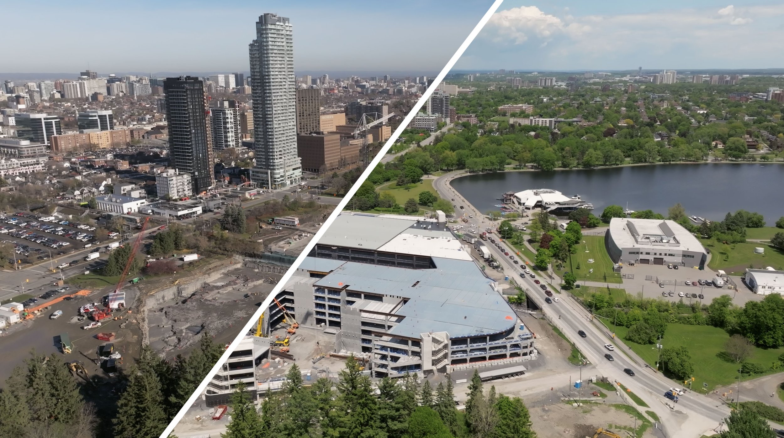
Photography and Videography
High-resolution aerial images and video taken at key milestones provide a powerful visual comparison, showcasing progress from initial site preparation to final completion.
High-Resolution Imagery: Crystal-clear photos and video highlight every detail, ideal for presentations or online galleries.
Consistent Perspectives: Drone flights ensure identical angles and altitudes for accurate, side-by-side comparisons.
Milestone Documentation: Images captured at critical phases (e.g., groundbreaking, framing, finishing) create a comprehensive project record.
Marketing Impact: Striking visuals boost promotional campaigns, investor updates, or real estate listings.
Interactive Web Display: Integrated galleries on your project webpage allow users to swipe between before and after images seamlessly.


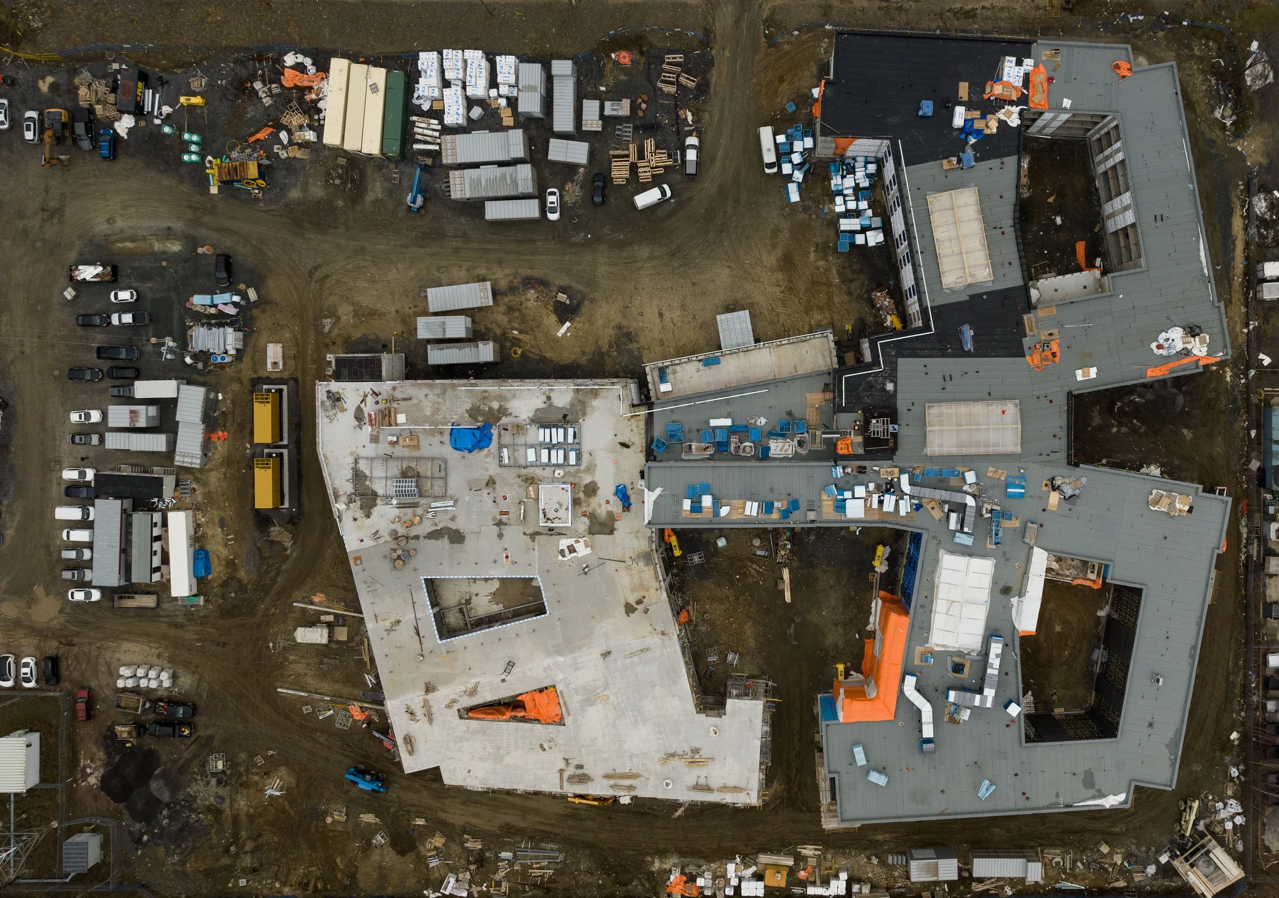
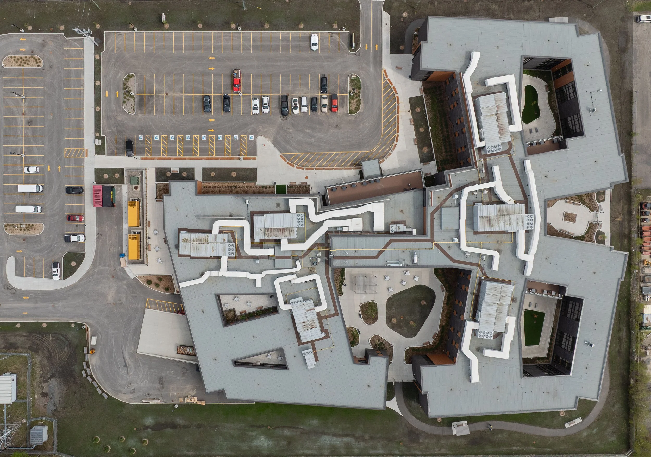
Orthomosaic Maps
Our drone-generated orthomosaic maps deliver precise, georeferenced 2D views of your construction site, providing a comprehensive and accurate perspective on progress and site conditions. Created by stitching together high-resolution aerial images, these maps support planning, monitoring, and stakeholder communication with unparalleled detail. Integrated into your custom project webpage, orthomosaic maps offer interactive tools for zooming, annotating, and comparing project phases, empowering data-driven decisions.
High-Resolution: Detailed, distortion-free maps enable precise site analysis.
Georeferenced Data: Aligns with GIS tools for integration with project plans or BIM models.
Progress Monitoring: Compare maps across phases to track earthworks, stockpiles, or layout changes.
Interactive Web Features: Embedded maps with zoom, pan, and annotation tools enhance usability on your project webpage.
Contact Us
